Inicio > Ciencias de la tierra, geografía, medioambiente, planificación > Ciencias de la tierra/geociencias > Geomorfologia tectónica da bacia hidrográfica do continente de Kutch, Índia
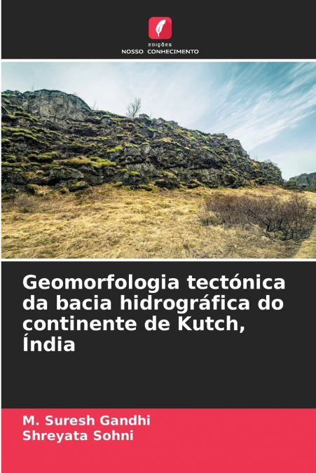
Geomorfologia tectónica da bacia hidrográfica do continente de Kutch, Índia

Geomorfologia tectónica da bacia hidrográfica do continente de Kutch, Índia

M. Suresh Gandhi / Shreyata Sohni

61,48 €
IVA incluido
Disponible
Editorial:
KS OmniScriptum Publishing
Año de edición:
2024
Materia
Ciencias de la tierra/geociencias
ISBN:
9786208205225
61,48 €
IVA incluido
Disponible

Selecciona una librería:

  • Librería Samer Atenea
  • Librería Aciertas (Toledo)
  • Kálamo Books
  • Librería Perelló (Valencia)
  • Librería Elías (Asturias)
  • Donde los libros
  • Librería Kolima (Madrid)
  • Librería Proteo (Málaga)

Kachchh é o segundo maior distrito da Índia, com uma área de 45.612 km2. Situa-se no extremo ocidental da Índia, com a sede distrital em Bhuj, uma pequena cidade histórica situada quase no centro do distrito e rodeada de dois lados por cadeias de montanhas. Kachchh possui uma terra única, salina e desolada, sem vegetação, com uma área total de 23 310 km2 conhecida como Rann. O distrito tem 9 Talukas, que cobrem 23,27% da área de todo o estado de Gujarat, embora contribua apenas com 3,03% da população do estado, com apenas 12,5 lakh pessoas. Kachchh é conhecida por ter uma população de gado superior à dos humanos, pela simples razão de possuir vastas pastagens de Banni, planícies costeiras e extensões aluviais de terras altas rochosas. A industrialização na última década afectou negativamente a topografia costeira e o ecossistema marinho de terra seca de Kachchh. A bacia dos rios Khari e Rukhmavati é um rio que corre transversalmente à KHF e flui na zona de charneira do planalto mediano de Kachchh. A análise morfométrica de ambas as bacias hidrográficas permite concluir que se trata de uma bacia controlada tectonicamente. As gargantas profundas em ambas as bacias indicam atividade neotectónica.


Artículos relacionados

  • Polarimetric SAR Techniques and Applications
    Carlos López-Martínez / Juan Manuel Lopez-Sanchez
    An increasing number of spaceborne Synthetic Aperture Radar (SAR) systems have been equipped with polarimetric capabilities: ALOS and ALOS-2, Radarsat-2, TerraSAR-X, Envisat-ASAR, Sentinel-1a/b, etc. Future mission will still present this type of diversity: RCM, SAOCOM, Cosmo-Skymed 2nd generation or PAZ. Polarimetry allows sensitivity to the structural and geometric properties...
    Disponible

    59,61 €

  • Innovative Strategies and Frameworks in Climate Change Adaptation
    Alexander G. Flor / Alexander GFlor / Benjamina Gonzalez Flor
    The changes the earth is currently undertaking has been at the forefront of scientific discourse in recent years. Humans as a species have needed to react to these changes and shift their behavior accordingly. Innovative Strategies and Frameworks in Climate Change Adaptation: Emerging Research and Opportunities is a critical scholarly resource that examines the relationship bet...
  • Air Quality Monitoring and Forecasting
    Air quality is personal. Its management is highly so. Asthmatic or air-pollutant-sensitive individuals depend on accurate air quality forecasts to help manage their daily activities.  However, the adverse effects of poor air quality on public health and visibility extend far beyond the daily time horizon. Pneumonic and cardiac vascular responses of individuals in all age groups...
    Disponible

    59,74 €

  • Application of Artificial Neural Networks in Geoinformatics
    Saro Lee
    Recently, a need has arisen for prediction techniques that can address a variety of problems by combining methods from the rapidly developing field of machine learning with geoinformation technologies such as GIS, remote sensing, and GPS. As a result, over the last few decades, one particular machine learning technology, known as artificial neural networks, has been successfull...
    Disponible

    59,81 €

  • Coastal Sea Levels, Impacts and Adaptation
    Extreme sea levels can lead to hazardous events, such as coastal flooding, erosion, or salt water intrusion, with-wide ranging environmental, societal, and economic consequences. In combination with climate-driven sea-level rise, and, potentially, additional changes in storminess, dynamic wave contributions, and tidal dynamics, the adverse consequences of extreme oceanographic ...
    Disponible

    75,97 €

  • Application of Plant Biotechnology in Forestry
    The aim of this reprint is to immerse the reader in the latest biotechnological approaches employed in forestry. From rejuvenation through clonal propagation to somatic embryogenesis, the cryopreservation of germplasm, and the use of molecular techniques and genetic engineering, we aim to unravel the potential and promise of these cutting-edge technologies. In this reprint, lea...

Otros libros del autor

  • Tektonische Geomorphologie des Flussgebiets von Kutch, Festland, Indien
    M. Suresh Gandhi / Shreyata Sohni
    Kachchh ist mit einer Fläche von 45.612 km² der zweitgrößte Distrikt Indiens. Er liegt im äußersten Westen Indiens, mit dem Distriktsitz in Bhuj, einer kleinen historischen Stadt, die fast in der Mitte des Distrikts liegt und von zwei Seiten von Hügelketten umgeben ist. Kachchh besitzt das einzigartige salzige und vegetationslose Land mit einer Gesamtfläche von 23.310 km², das ...
    Disponible

    61,48 €

  • Géomorphologie tectonique du bassin fluvial du continent de Kutch, Inde
    M. Suresh Gandhi / Shreyata Sohni
    Kachchh est le deuxième plus grand district de l’Inde avec une superficie de 45 612 km². Il est situé à l’extrémité ouest de l’Inde et le siège du district se trouve à Bhuj, une petite ville historique située au centre du district et entourée de deux côtés par les chaînes de collines. Kachchh possède une terre saline et désolée, sans végétation, d’une superficie totale de 23 31...
    Disponible

    61,48 €

  • Geomorfologia tettonica del bacino fluviale del Kutch continentale, India
    M. Suresh Gandhi / Shreyata Sohni
    Kachchh è il secondo distretto più grande dell’India, con un’area di 45.612 kmq. È situato all’estremità occidentale dell’India e la sede del distretto si trova a Bhuj, una piccola città storica situata al centro del distretto e circondata da due lati da catene collinari. Kachchh possiede una terra unica, salina e desolata, priva di vegetazione, con un’area totale di 23.310 km²...
    Disponible

    61,48 €