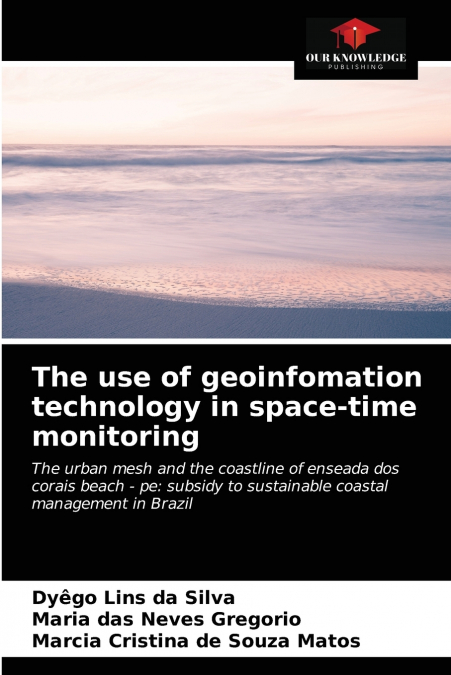
The use of geoinfomation technology in space-time monitoring

The use of geoinfomation technology in space-time monitoring

Dyego Lins da Silva / Marcia Cristina de Souza Matos / Maria das Neves Gregorio

60,32 €
IVA incluido
Disponible
Editorial:
KS OmniScriptum Publishing
Año de edición:
2021
Materia
Ciencias de la tierra/geociencias
ISBN:
9786204028019
60,32 €
IVA incluido
Disponible

Selecciona una librería:

  • Donde los libros
  • Librería 7artes
  • Librería Elías (Asturias)
  • Librería Kolima (Madrid)
  • Librería Proteo (Málaga)

This book aimed to raise, measure, analyze and calculate the forecast of Future Scenarios, on the space-time monitoring of the urban network and the coastline of the beach Enseada dos Corais - Cabo de Santo Agostinho - Pernambuco, in the last forty-one (41) years; using the technologies of Geoinfomation (GPS, UAV, Geoprocessing, GIS among others), subsidizing the sustainable coastal management of this coast. For this, the methodology used comprises the use of current and past cartographic documents, such as: photographs of areas from 1974, 1981, 1997; and, field survey of the coastlines 2010 and 2015, using geodesic equipment and GPS/GNSS receivers, added to the survey and acquisition of aerial images by Unmanned Aerial Vehicle (UAV). The reference year for the calculation of the lines was 1974 and the other years. The results in the average rates of displacement of the coast line were 1.09 m/year (1974-1981), 0.31 m/year (1974-1997), 0.47 m/year (1974-2010), -1.06 m/year (1974-2015); presenting accelerated erosion from 2010. The research provides scientific data to support Coastal Management Plans.

Artículos relacionados

  • Polarimetric SAR Techniques and Applications
    Carlos López-Martínez / Juan Manuel Lopez-Sanchez
    An increasing number of spaceborne Synthetic Aperture Radar (SAR) systems have been equipped with polarimetric capabilities: ALOS and ALOS-2, Radarsat-2, TerraSAR-X, Envisat-ASAR, Sentinel-1a/b, etc. Future mission will still present this type of diversity: RCM, SAOCOM, Cosmo-Skymed 2nd generation or PAZ. Polarimetry allows sensitivity to the structural and geometric properties...
    Disponible

    59,61 €

  • Innovative Strategies and Frameworks in Climate Change Adaptation
    Alexander G. Flor / Alexander GFlor / Benjamina Gonzalez Flor
    The changes the earth is currently undertaking has been at the forefront of scientific discourse in recent years. Humans as a species have needed to react to these changes and shift their behavior accordingly. Innovative Strategies and Frameworks in Climate Change Adaptation: Emerging Research and Opportunities is a critical scholarly resource that examines the relationship bet...
    Disponible

    216,16 €

  • Air Quality Monitoring and Forecasting
    Air quality is personal. Its management is highly so. Asthmatic or air-pollutant-sensitive individuals depend on accurate air quality forecasts to help manage their daily activities.  However, the adverse effects of poor air quality on public health and visibility extend far beyond the daily time horizon. Pneumonic and cardiac vascular responses of individuals in all age groups...
    Disponible

    59,74 €

  • Application of Artificial Neural Networks in Geoinformatics
    Saro Lee
    Recently, a need has arisen for prediction techniques that can address a variety of problems by combining methods from the rapidly developing field of machine learning with geoinformation technologies such as GIS, remote sensing, and GPS. As a result, over the last few decades, one particular machine learning technology, known as artificial neural networks, has been successfull...
    Disponible

    59,81 €

  • Coastal Sea Levels, Impacts and Adaptation
    Extreme sea levels can lead to hazardous events, such as coastal flooding, erosion, or salt water intrusion, with-wide ranging environmental, societal, and economic consequences. In combination with climate-driven sea-level rise, and, potentially, additional changes in storminess, dynamic wave contributions, and tidal dynamics, the adverse consequences of extreme oceanographic ...
    Disponible

    75,97 €

  • Checklist of Papuasian Orchids
    Paul Ormerod
    This is the most comprehensive account to date of all Papua New Guineas wild orchids and will no doubt prove to be the essential reference to PNG's orchids for all botanists, ecologists and orchid enthusiasts for decades to come. All types and relevant data including where published are listed and the herbariums where they are kept. All synonymous names, where published and...
    Disponible

    59,91 €

Otros libros del autor

  • Den einsatz der geoinformationstechnologie bei der raum-zeit-überwachung
    Dyego Lins da Silva / Marcia Cristina de Souza Matos / Maria das Neves Gregorio
    Dieses Buch zielt darauf ab, die Vorhersage von Zukunftsszenarien zu erheben, zu messen, zu analysieren und zu berechnen, auf der Raum-Zeit-Überwachung des städtischen Netzes und der Küstenlinie des Strandes Enseada dos Corais - Cabo de Santo Agostinho - Pernambuco, in den letzten einundvierzig (41) Jahren; unter Verwendung der Technologien der Geoinfomation (GPS, UAV, Geoproce...
    Disponible

    59,08 €

  • L’utilisation de la technologie de géoinfomation dans la surveillance spatio-temporelle
    Dyego Lins da Silva / Marcia Cristina de Souza Matos / Maria das Neves Gregorio
    Ce livre avait pour but d’élever, de mesurer, d’analyser et de calculer la prévision des scénarios futurs, sur le suivi spatio-temporel de la maille urbaine et du littoral de la plage Enseada dos Corais - Cabo de Santo Agostinho - Pernambuco, au cours des quarante et une (41) dernières années ; en utilisant les technologies de la Géoinfomation (GPS, UAV, Géotraitement, SIG entr...
    Disponible

    60,38 €

  • L’uso della tecnologia di geoinfomazione nel monitoraggio spazio-temporale
    Dyego Lins da Silva / Marcia Cristina de Souza Matos / Maria das Neves Gregorio
    Questo libro mira a sollevare, misurare, analizzare e calcolare la previsione di Scenari Futuri, sul monitoraggio spazio-temporale della maglia urbana e la linea di costa della spiaggia Enseada dos Corais - Cabo de Santo Agostinho - Pernambuco, negli ultimi quarantuno (41) anni; utilizzando le tecnologie di Geoinfomazione (GPS, UAV, Geoprocessing, GIS tra gli altri), sovvenzion...
    Disponible

    60,32 €