
 Librería Samer Atenea
 Kálamo Books
 Librería Elías (Asturias)
 Librería Kolima (Madrid)
 Librería Proteo (Málaga)
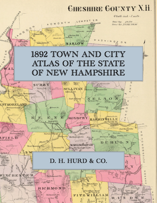
Facsimile of the 1892 Town and City Atlas of the State of New Hampshire, published by D. H. Hurd & Co. of Boston, reproduced in full colour. It covers the whole state: a map of New Hampshire, hand-coloured maps of all ten counties (Rockingham, Strafford, Belknap, Carroll, Merrimack, Hillsborough, Cheshire, Sullivan, Grafton and Coos), a plan of every one of the 234 towns with insets of their villages, and detailed street plans of the cities of Manchester, Concord, Nashua, Portsmouth, Dover, Keene, Laconia, Rochester, Somersworth, Franklin, Claremont, Berlin, Lebanon, Littleton, Exeter and Newport.The county maps and town plans name the roads, rivers, ponds, railroads and stations, mills, churches, schools, cemeteries and post offices, and mark the house of each householder by name, so that a family, a farm or a mill can be placed on the ground as it stood in 1892. The city plans go further, showing the street grids, wards, blocks and individual buildings of the mill cities on the Merrimack and the Cocheco and of the seaport at Portsmouth. Dozens of engraved views record the hotels, mills, academies, seminaries, churches and residences of the day.D. H. Hurd & Co. compiled the atlas from government surveys, county records and personal investigation, and it remains the standard record of New Hampshire’s towns at the close of the nineteenth century. This Exile Books edition is a facsimile republication of the complete atlas of maps, plans and views, printed at 8.5 x 11 inches on premium colour paper; the statistical tables and business directories of the original letterpress are not included. Ideal for local historians, genealogists, town and church historians, and anyone tracing a New Hampshire family, farm or village back to 1892.